Aklan (Province of Aklan)
 |
 |
Aklan is most well-known for Boracay, a resort island 0.8 kilometer north of the tip of Panay. It is known for its white sand beaches and is considered one of the more prominent destinations in the country. The Ati-Atihan Festival of Kalibo has also been known worldwide, hence declared "The Mother of all Philippine Festivals." It is an annual celebration held on the third Sunday of January to honor the Sto. Niño (Infant Jesus). The festival showcases tribal dancing through the town's main streets to the tune of ethnic music, with participants in indigenous costumes and gear.
Aklan is believed to have been settled in the 13th century by settlers from Borneo, ruled by the chieftain Datu Dinagandan which traded with its neighbouring islands. Aklan then became a part of the Kedatuan of Madja-as.
Towards the end of the 13th century, Datu Dinagandan moved the capital from what is now Batan. In 1433, Datu Kalantiaw's grandson and successor, Datu Kalantiaw III, was said by Jose Marcos to have formulated a set of laws known today as the Code of Kalantiaw. Well-respected scholarly long-term Philippine resident historian William Henry Scott proved these "laws" to be a total fabrication.
In 1437, the short-lived dynasty of Datu Kalantiaw ended when Datu Kalantiaw III was killed in battle with the tribes of Datu Manduyog, the legitimate successor of Datu Dinagandan. When Datu Manduyog became the new chieftain, he moved the capital to Bakan (now known as Banga).
Several datus succeeded Datu Manduyog until the Spanish explorer Miguel López de Legazpi landed in Batan in 1565 and claimed the island for Spain, in early Spanish accounts it was called El Río de Aclán. Datu Kabanyag was the chieftain at that period and had his capital in Libacao.
In 1942, the Japanese invaded Aklan during World War II. In 1945, combined Filipino and American army along with Aklanon guerrillas liberated Aklan during the war in the Pacific.
Aklan (Akean) became an independent province through Republic Act No. 1414 signed by Philippine President Ramon Magsaysay on April 25, 1956, separating Aklan from Capiz. The original towns were Altavas, Balete, Batan, Banga, Buruanga, Ibajay, Kalibo, Lezo, Libacao, Madalag, Malay, Makato, Malinao, Nabas, New Washington, Numancia, and Tangalan, then all part of the province of Capiz. The province was inaugurated on November 8, 1956. Jose Raz Menez was appointed the first governor of Aklan by President Magsaysay and he served until December 30, 1959. In 1960, Godofredo P. Ramos became the first elected governor but upon resigning to run for Congress he was succeeded by the vice governor, Virgilio S. Patricio. In 1964, José B. Legaspi succeeded Patricio and he held office for two consecutive terms from 1964 to 1971.
Map - Aklan (Province of Aklan)
Map
Country - Philippines
 |
 |
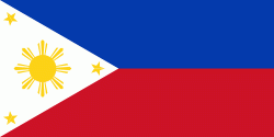
| Flag of the Philippines | |
Negritos, some of the archipelago's earliest inhabitants, were followed by successive waves of Austronesian peoples. Adoption of animism, Hinduism and Islam established island-kingdoms called Kedatuan, Rajahnates, and Sultanates. The arrival of Ferdinand Magellan, a Portuguese explorer leading a fleet for Spain, marked the beginning of Spanish colonization. In 1543, Spanish explorer Ruy López de Villalobos named the archipelago Las Islas Filipinas in honor of Philip II of Spain. Spanish settlement through Mexico, beginning in 1565, led to the Philippines becoming ruled by the Spanish Empire for more than 300 years. During this time, Catholicism became the dominant religion, and Manila became the western hub of trans-Pacific trade. In 1896, the Philippine Revolution began, which then became entwined with the 1898 Spanish–American War. Spain ceded the territory to the United States, while Filipino revolutionaries declared the First Philippine Republic. The ensuing Philippine–American War ended with the United States establishing control over the territory, which they maintained until the Japanese invasion of the islands during World War II. Following liberation, the Philippines became independent in 1946. Since then, the unitary sovereign state has often had a tumultuous experience with democracy, which included the overthrow of a decades-long dictatorship by a nonviolent revolution.
Currency / Language
| ISO | Currency | Symbol | Significant figures |
|---|---|---|---|
| PHP | Philippine peso | ₱ | 2 |
| ISO | Language |
|---|---|
| EN | English language |
| TL | Tagalog language |


